Who We Are

SAWiE is offering data-driven solutions to farmers to better manage their farms independently. The SAWiE solutions are empowered by remote sensing tools which include the Earth Observation and ground-based sensors are adopted to meet the needs of all farm types, especially smallholder farms. It will help to improve crop productivity, yield and gain better returns on investment.

 

Decision Making Tool

The Sawie tools enable farmers to adopt optimum about managing their crops including irrigation, targeted scouting, an indication of troubled areas, scheduled and optimized watering scheme,  nutrients, and crop protection measures by offering real-time information about geophysical and biophysical parameters.

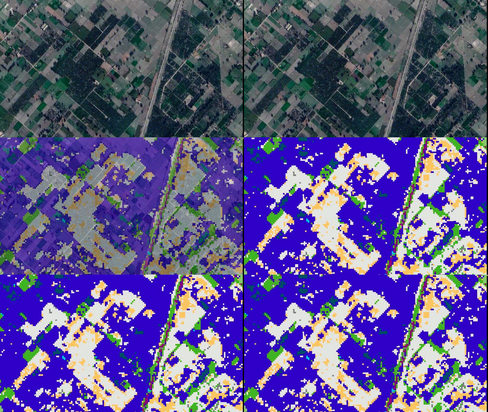
The Sawie tested tools rely on remote sensing using global data resources while data collection is carried out using novel and innovative data sensing techniques that includes Earth Observation/Satellites observation, drones, imaging, sensors, GIS covering small farms. The data is processed through innovative data mining techniques including AI and Machine Learning then is aligned with the prominent crop modeling tools that include Aqua Crops and other open-source models etc. Providing satellite-based precision agronomy Sawie promotes sustainable agronomy by impacting the social, economical, and environmental Aspects, hence trying to achieve  UN’s Sustainable Development Goals.

Sawie Knowledge Center
Crop Management
Sawie helps farmer manage corps and fields using sowing, harvesting, pest, irrigation and yield estimations and alerts
Weather Alert
Sawie provides accurate weather updates and alerts for the perticular field.

Real Time data
Sawie is an analytical farmer advisory tool based on real time data that is nearly accurate.
Pest Control
Sawie is an un-biased advisory tool that helps in crop pest and desease control.

How We Do It!

The Sawie tested tools rely on remote sensing using global data resources while data collection is carried out using novel and innovative data sensing techniques that include Earth Observation/Satellites observation, drones, imaging, sensors, GIS covering small farms. The data is processed through innovative data mining techniques including AI and Machine Learning then is aligned with the prominent crop modeling tools that include AquaCrops and other open-source models etc. Providing satellite-based precision agronomy Sawie promotes sustainable agronomy by impacting the social, economical, and environmental Aspects, hence trying to achieve  UN’s Sustainable Development Goals.

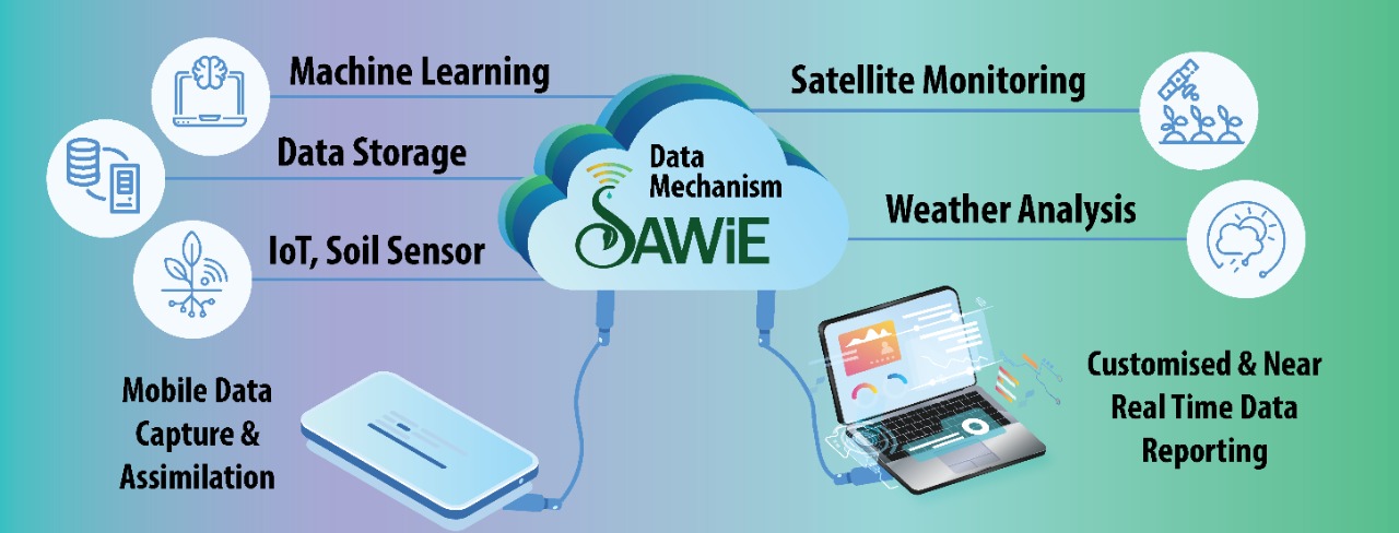
Machine Learning

Sawie make use of sophisticated machine learning algorithms to perform various automated tasks.

Data Storage

Sawie stores huge data for precise analysis and decision making.

IoT, Soil Sensors

Sawie make use of latest technologies for sowing, harvesting and yield estimation alerts.

Satellite Monitoring

Sawie uses satellite dats for real time farm and crop monitoring, soil monitoring, weather alerts, and more.

Weather Analysis

Sawie gives daily, weekly and hourly weather analysis of the farm.

Customized & Near Real Time Data Reporting

Sawie data analysis is based on real time data analysis which makes it more reliable and adaptable for land owners and farmers.

Real Time Information

SAWiE offers real-time information to farmers to make early decisions for crop management including irrigation, nutrients application, and crop protection measures. SAWiE provides high-level information about the growing season, early crop yield estimates, early threats of any particular insect pests and diseases. SAWiE is very much supportive of individual farmers’ data privacy and will be only developing tools that provide anonymous information about a village, region, and bigger area. The corporate clients include the governments, donor agencies, agritech industry, supplier, food supply chain, and financial sector players that includes banks and the insurance industry.

Future Farming

The SAWiE tested tools rely on remote-sensing using global data resources on weather , soils, water, nutrients, crop health, etc. The real-time/ early-stage data is collected using novel and innovative data sensing techniques that include Earth Observation/Satellites observation, drones, imaging, sensors covering large areas. The data is processed through innovative data mining techniques including AI and Machine Learning. The data is aligned with the prominent crop modeling tools that includes AquaCrops and other open-source models etc.

Write to us

You may contact us by filling this form for queries and suggestions. You can also fill in the form to leave your comments or feedback.